
GÖKTÜRK-1 Satellite Imagery
Göktürk
Swath Width
15 × 15 Km
Ground Sampling Distance
Pan: 0.5 m / MS: 2 m
Bands
- Pan = 450–845 nm
- Blue = 435–554 nm
- Green = 493–607 nm
- Red = 606–717 nm
- Near Infrared (NIR) = 691–933 nm
Revisit Time
- 2 days or less at latitudes 30° and above with a ±45° viewing angle
- 3 days or less at latitudes 40° and above with a ±30° viewing angle
Positional Accuracy
- Horizontal (CE90) – without ground control point < 10 m
- Horizontal (CE90) – with ground control point < 2 m
- Vertical (LE90) – without ground control point < 20 m
- Vertical (LE90) – with ground control point < 3 m
MODE 01SPOT
15 km × 15 km (at Nadir), in both PAN and multispectral bands or at varying roll angles [-45° to 45°] and pitch angles [-30° to 30°].
MODE 02STRIP
Strip collection length can range from 15 km up to a maximum of 3480 km depending on the compression ratio.
MODE 03STEREO
In a single pass, the length of a stereo strip image can range from 15 km to 410 km depending on the average forward/backward pitch angle.
MODE 04WIDE AREA
Wide areas in the north-south direction (2 to 5 strips), wide areas in the east-west direction (2 to 4 strips), single-pass wide area stereo image (2 stereo strips of 45 km each).
Levels provided by IMPRO;
L0
Raw image
L1
Radiometrically corrected image (detector errors, noise and blur removed)
L2A
Geometrically corrected image (errors from the Earth's curvature and orientation removed)
L2B
Image obtained by georectifying the L2A-level image (projected onto the specified ellipsoid model)
L3A
Orthophoto image
L3B
Orthophoto image produced using ground control points (GCP)
L4
Digital elevation model generated from stereo image pairs
L5
Mosaicked image
L6
Classified image
It delivers the level data of the GÖKTÜRK-1 EO Satellite to its customers.
Promotional Video
GÖKTÜRK-1 Promotional Video
About GÖKTÜRK-1
Built under the management of the Presidency of Defence Industries through a TELESPAZIO and TUSAŞ partnership, GÖKTÜRK-1 is a high resolution optical remote sensing satellite. Launched into orbit on 5 December 2016, GÖKTÜRK-1 continues its operations successfully today.
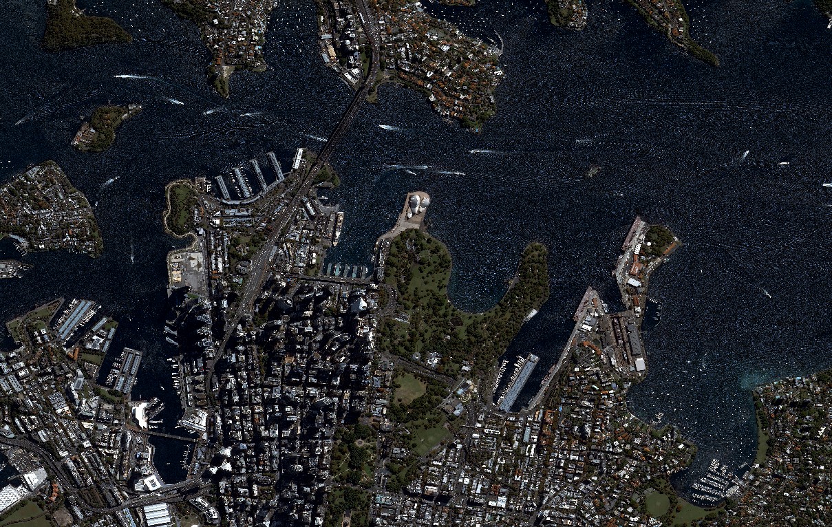 GÖKTÜRK-1 · 0.5 m PAN