
Change & Deformation Analysis
For environmental and urban planning management, performing change analyses in designated regions and high-precision monitoring of deformations in critical buildings and facilities using satellite optical and SAR imagery.
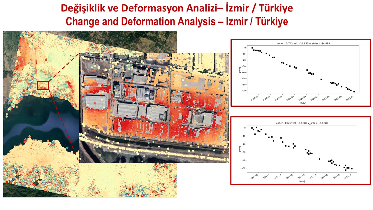
Monitoring changes on the Earth's surface caused by human activity, natural events or geological processes with precision down to the millimetre is critical for infrastructure safety and risk management. Optical and radar (SAR) satellite imagery provides regular and reliable observation over wide geographies:
- Monitoring Surface and Structural Deformation: Using Interferometric SAR (InSAR) techniques to map settlement and displacement of infrastructure such as dams, bridges and high-rise structures with millimetre precision.
- Urban and Rural Change Detection: Automatically identifying new construction, illegal building, deforestation and land use change from archive and current optical imagery.
- Post-Disaster Damage Assessment: Rapidly classifying ground deformation and destroyed or damaged areas after earthquakes, landslides or fault movements.
- Temporal Trend and Early Warning Analyses: Modelling periodic movement patterns from multi-temporal satellite series and identifying at-risk areas through early warning systems before structural failure occurs.
Satellite-based change and deformation analysis gives decision makers a precise and sustainable monitoring infrastructure.
Get in touch with us
for your image request.
Türkiye's image processing centre of excellence for GÖKTÜRK-1 satellite imagery — processing, distribution and intelligence production.