
Emergency Mapping
In disaster and emergency management, customised maps and analyses are delivered in the shortest possible time following the acquisition of satellite and airborne imagery (Optical and SAR) for post-disaster damage assessment.
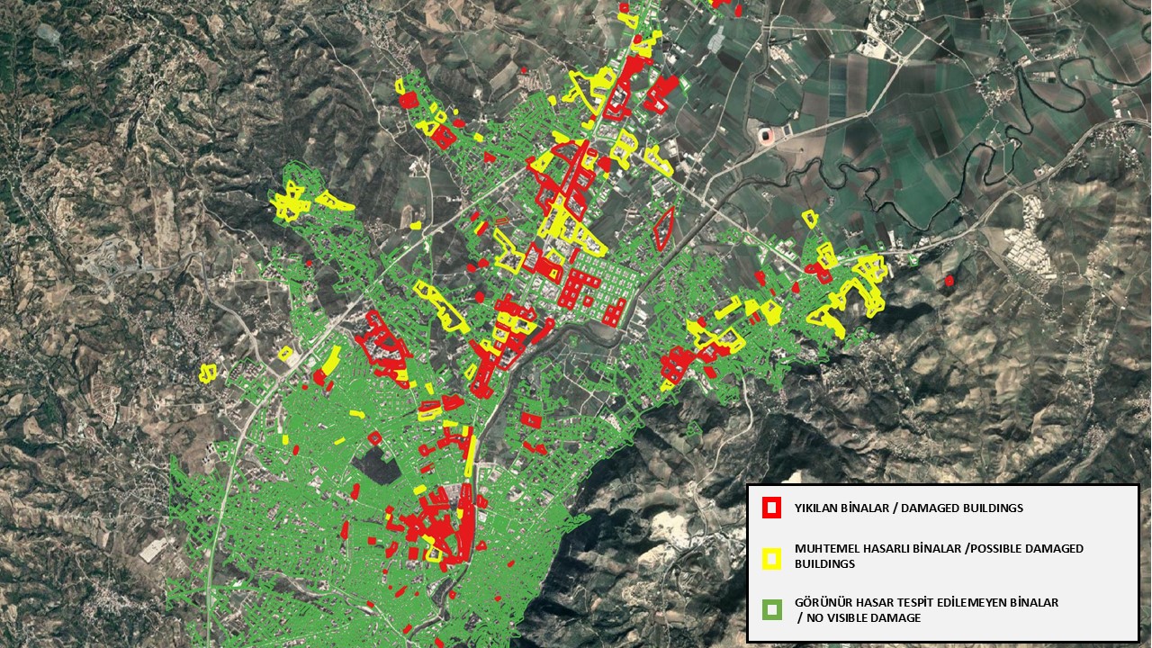
Fast and Reliable Decision Support in Times of Crisis: Emergency Mapping
The first hours after a natural or man-made disaster such as an earthquake, flood, forest fire or landslide are the most critical phase of crisis management. Safely directing field teams, determining the extent of damage and planning relief logistics all depend on accurate, up-to-date spatial data covering wide areas. Emergency mapping turns the scattered information coming from the field into structured, operational maps and gives decision makers instant situational awareness.
In regions where adverse weather follows a disaster, satellite technology is the most effective means of observation. The high and very high resolution optical and SAR (Synthetic Aperture Radar) satellite data offered by IMPRO supports the emergency analysis process end to end.
Access to the right data at the right time is the basic condition for minimising loss of life and damage. With high resolution satellite imagery and advanced remote sensing solutions, IMPRO continues to be the eyes of disaster management teams in the field.
Get in touch with us
for your image request.
Türkiye's image processing centre of excellence for GÖKTÜRK-1 satellite imagery — processing, distribution and intelligence production.